land slide control mechanism
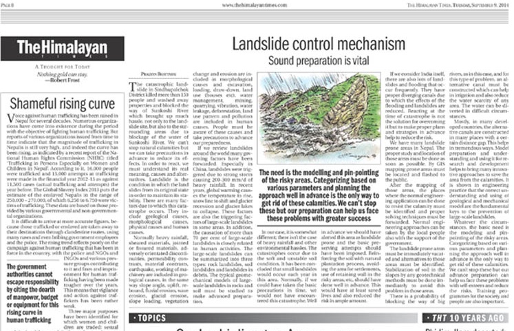
The need is the modelling and pin pointing of the of the risky areas. Categorization based on various parameters and planning the approach well in advance is the only way to get rid of such calamities.
Rainfall-triggered slope failures are common across various geological, topographical, and geohydrological environments. However, in some cases, the slow and steady percolation process can weaken the region and lead to catastrophic outcomes. The devastating landslide in Sindhupalchok District, which resulted in significant loss of life and property, exemplifies this phenomenon. While we cannot prevent natural disasters, we can take preventive measures to mitigate their effects. Extensive research has identified numerous factors that contribute to slope failures. A thorough understanding of the geological environment, along with proper evaluation of the geotechnical and geohydrological characteristics of soil and rock masses, is crucial for assessing slope stability. To prevent large-scale landslides, it is essential not to overlook smaller landslides that have occurred. Comprehensive investigations should include aerial photo interpretation, surface mapping, subsurface investigation, in-situ hydraulic conductivity tests of soil, in-situ strength tests of rocks, and laboratory analyses of soils and rocks.
Before proceeding, it is important to understand the nature and causes of landslides. A landslide occurs when land shifts from its original state, compromising its stability. Various factors contribute to this phenomenon, including geological, morphological, physical, and human causes. Geological causes include heavy rainfall, sheared materials, jointed or fissured materials, adversely oriented discontinuities, permeability contrasts, material contrasts, earthquakes, and machinery operations. Morphological causes encompass slope angle, uplift, rebound, fluvial erosion, wave erosion, glacial erosion, slope loading, vegetation change, and erosion. Human causes involve excavation, loading, draw-down, land use (e.g., housing), water management, mining, quarrying, vibration, water leakage, deforestation, land use patterns, and pollution. Awareness of these causes and taking appropriate precautions can enhance preparedness.
A review of landslides worldwide reveals various governing factors. In China, for example, landslides have been triggered by intense storms causing 200-300 mm/day of heavy rainfall. Recent global warming has led to rising temperatures, shifting snow lines, glacier recession, and glacier lake collapses, which contribute to large-scale landslides. Moreover, over 70 percent of large-scale landslides are closely linked to human activities. These landslides can be categorized into three types: rock landslides, soil landslides, and landslides in debris. Studying the geomechanical models of large-scale landslides in rocks and soil is essential for advanced preparation.
In our case, the situation differs as there was no heavy rainfall or significant environmental disturbance. The catastrophe was due to soft and unstable soil conditions. It has been noted that small landslides occur annually in this area, and the road consolidation at the site had been observed for some time. Despite this, the area was not classified as a high-risk zone for landslides. Timely basic precautions could have prevented this disaster. Early identification of the area as landslide-prone and implementing preventive measures, such as reinforcing soil with natural vegetation, avoiding settlement in risky areas, and using retaining walls, could have saved lives and significantly reduced risk.
In India, frequent landslides and flooding are mitigated by proper drainage systems. Addressing catastrophes in real-time is not sufficient; effective planning and strategies in advance are crucial for risk reduction. These incidents highlight the need for government attention in proactive planning.
Nepal also has numerous landslide-prone areas that require immediate study and mapping using GIS. Public dissemination of this information is necessary. Once mapped, areas where engineering solutions can be applied to mitigate calamities should be identified, and appropriate techniques should be implemented. Simple yet effective remedies include general surface drainage in upper and middle slopes, subsurface drainage, free-flow canals, and surface reservoirs at lower slopes. While the government plays a critical role, local communities can also contribute through basic engineering practices with governmental support. Immediate evacuation and identification of alternatives for landslide-prone areas are essential. Stabilizing soil in slopes using geotechnical methods should be prioritized to address these issues.
For large rivers, alternative canals should be constructed to manage river flow, aid irrigation, and reduce water scarcity. These canals can also help manage flooding and submerge nearby areas. Many developed countries construct alternative canals at regular intervals, which provides significant benefits. Proper study and implementation of these measures are essential.
Model preparation and understanding are vital for research and development approaches to mitigate calamities. In Nepal, while many donations are invested in these efforts, their effectiveness remains limited. Correctly understanding and utilizing geological and mechanical models are fundamental to preventing large-scale landslides. Advanced preparation through modeling and pinpointing risky areas, categorizing factors, and planning proactively is essential to mitigate these disasters. Although we cannot prevent such events entirely, advance preparation allows us to face them with resilience and reduce risk. Training programs for society and individuals are also crucial for effective implementation.
Nepali Version
वृष्टि जन्य ढलान अस्थिरता: विश्लेषण र पूर्वतैयारी
वृष्टिले उत्पन्न गर्ने ढलान अस्थिरता विभिन्न भूगर्भीय, भौगोलिक, र भूजलविज्ञानीय वातावरणमा सामान्य रूपमा पाइन्छ। तर कहिलेकाहीं, धिमा र स्थिर पानीको अवशोषण प्रक्रियाले क्षेत्रलाई नरम बनाउँछ र विनाशकारी परिणाम निम्त्याउँछ। सिंधुपालचोक जिल्लामा भएको विनाशकारी भूस्खलन पनि यस्तै थियो जसले धेरै जीवन र सम्पत्ति बगाएर गयो। हामी प्राकृतिक प्रकोपलाई रोक्न सक्दैनौं तर यसका प्रभावलाई कम गर्नका लागि पूर्वतैयारी गर्न सक्छौं। व्यापक अनुसन्धानले भूस्खलनका लागि विभिन्न कारकहरूलाई पहिचान गरेको छ। भूस्खलनको स्थिरता मूल्याङ्कनको लागि भूगर्भीय वातावरणको गहिरो बुझाइ र माटो र चट्टानका समूहहरूको भूअवस्था र भूजलविज्ञानी विशेषताहरूको सही मूल्याङ्कन अत्यन्त महत्वपूर्ण छ। ठूला भूस्खलनलाई रोक्नको लागि, भएका साना भूस्खलनलाई नजरअन्दाज गर्नु हुँदैन। विस्तृत अनुसन्धानमा हवाई फोटो विश्लेषण, सतह मानचित्रण, भुईयां अनुसन्धान, माटोको इन-सिटु हाइड्रोलिक कन्डक्टिविटी परीक्षण, चट्टानको इन-सिटु बल परीक्षण, र माटो र चट्टानको प्रयोगशाला विश्लेषण समावेश हुनु पर्छ।
यस अघि, भूस्खलन र यसको कारणहरूलाई बुझ्न महत्त्वपूर्ण छ। भूस्खलन तब हुन्छ जब भूमिले यसको मूल अवस्थाबाट खस्छ, जसले यसको स्थिरता बिगार्छ। विभिन्न कारणहरूले यो घटना निम्त्याउँछन्, जसमा भूगर्भीय, भौगोलिक, भौतिक, र मानव कारणहरू समावेश छन्। भूगर्भीय कारणहरूमा भारी वृष्टि, शीयर गरिएका सामग्रीहरू, जोडिएका वा फाटिएका सामग्रीहरू, प्रतिकूल रूपले ओरिएका खण्डहरू, पारगम्यता भिन्नता, सामग्री भिन्नता, भूकम्प, र मेशिनरी सञ्चालन समावेश छन्। भौगोलिक कारणहरूमा ढलानको कोण, उचाइ, पुनरावृत्ति, नदीनाला क्षति, लहर क्षति, ग्लेशियर क्षति, ढलान लोड, वनस्पति परिवर्तन, र क्षति समावेश छन्। मानव कारणहरूमा उत्खनन, लोडिङ, ड्र-डाउन, भूमि प्रयोग (जस्तै, घरहरू), पानी व्यवस्थापन, खनन, ढुङ्गा उत्खनन, कम्पन, पानी चुहावट, वनावन, भूमि प्रयोगको ढाँचा, र प्रदूषण समावेश छन्। यी कारणहरूको अवबोधन र उचित सावधानी अपनाउँदा तयार रहनमा मद्दत पुग्न सक्छ।
विश्वभरिका भूस्खलनहरूको समीक्षा गर्दा विभिन्न शासकीय कारकहरूलाई चिनिएको छ। विशेष गरी चीनमा, बलियो तुफानले २००-३०० मिमी/दिनको भारी वृष्टि गराएकोले भूस्खलन उत्पन्न भएको छ। हालका वर्षहरूमा, वैश्विक तातोले तापक्रम वृद्धि, हिउँको रेखा स्थानान्तरण, ग्लेशियर घटाउने, र ग्लेशियर तालको पतन गराएको छ, जसले ठूलो मात्रामा भूस्खलन निम्त्याउँछ। थप रूपमा, ७० प्रतिशत भन्दा बढी ठूलो भूस्खलन मानव क्रियाकलापसँग नजिकको सम्बन्ध राख्छ। ठूलो भूस्खलनलाई तीन प्रकारमा वर्गीकृत गर्न सकिन्छ: चट्टान भूस्खलन, माटो भूस्खलन, र मलबा भूस्खलन। चट्टान र माटोमा ठूलो भूस्खलनका भौगोलिक मोडेलहरूको अध्ययनले पूर्व तयारीको लागि महत्त्वपूर्ण छ।
हाम्रो केसमा, स्थिति फरक छ; यहाँ कुनै भारी वृष्टि र अन्य पर्यावरणीय समस्या थिएन। विपत्ति नरम र अस्थिर माटोको अवस्थाका कारण उत्पन्न भएको हो। यो क्षेत्रमा प्रत्येक वर्ष साना भूस्खलन हुने सम्भावना रहेको छ र विपत्तिमा भएका सडकमार्गको एकत्रण लामो समयदेखि देखिन्छ। यद्यपि, यो क्षेत्रलाई उच्च जोखिमको क्षेत्रको रूपमा सूचीबद्ध गरिएको थिएन। समयमै आधारभूत सावधानी अपनाउँदा यो विपत्ति रोकिन सक्थ्यो। पूर्वमा यस क्षेत्रलाई भूस्खलन प्रवण क्षेत्रको रूपमा चेतावनी दिनु र रोकथामका उपायहरू लागू गर्नु आवश्यक थियो। प्राकृतिक वनस्पतिद्वारा माटोलाई सुदृढ पार्नु, जोखिमपूर्ण क्षेत्रहरूमा बसोबासबाट बच्नु, र जोखिमपूर्ण क्षेत्रहरूमा संरक्षण पर्खालको प्रयोग गर्नाले जीवनलाई बचाउन र जोखिमलाई कम गर्न मद्दत पुग्न सक्थ्यो।
भारतमा पनि भूस्खलन र बाढी सामान्य रूपमा हुन्छ। उनीहरूसँग प्रभावकारी डाइभर्टिङ च्यानलहरू छन् जसले बाढी र भूस्खलनका प्रभावलाई कम गर्छ। विपत्तिका समयमा प्रतिक्रिया मात्र समाधान होइन, तर पूर्व योजनाबद्ध र रणनीतिहरूले जोखिमलाई कम गर्न मद्दत गर्दछ। यी घटनाहरूले सरकारलाई अग्रिम योजना बनाउनको आवश्यकता झल्काउँछन्।
नेपालमा पनि थुप्रै भूस्खलन प्रवण क्षेत्रहरू छन् जुन तुरुन्त अध्ययन र GIS मार्फत मानचित्रण गर्न आवश्यक छ। यो जानकारी सर्वसाधारणमा प्रसारित गर्नुपर्छ। मानचित्रणपछि, प्राविधिक समाधान लागू गर्न सकिने क्षेत्रहरूलाई पहिचान गरेर उचित समाधान विधिहरू लागू गर्नुपर्छ। सामान्य सतह निकास माथिल्लो र मध्यम ढलानका भागहरूमा, भुईयां निकास, स्वत: प्रवाह च्यानलहरू, र तलको ढलानमा सतह जलाशयहरू साधारण तर प्रभावकारी उपायहरू हुन सक्छन्। सरकारको भूमिका महत्त्वपूर्ण छ, तर स्थानीय समुदायले पनि प्राविधिक अभ्यास गर्न सक्नेछन्। भूस्खलन प्रवण क्षेत्रहरूलाई तुरुन्त खाली गर्नु र वैकल्पिक उपायहरूको पहिचान गर्नु आवश्यक छ। स्लोपमा माटोको सुदृढीकरणको लागि कुनै पनि भूविज्ञानिक विधिहरू लागू गर्नु पर्छ।
ठूला नदीहरूको किनारमा, नदीको मार्ग अवरुद्ध हुने सम्भावना पनि रहन्छ र यस समस्याका लागि वैकल्पिक च्यानल निर्माण गर्नु पर्छ जसले सिँचाइमा मद्दत गर्न सक्छ र पानीको कमीलाई कम गर्न सक्छ। यी च्यानलहरूले बाढीको व्यवस्थापनमा र नदीका छेउका क्षेत्रहरूमा पानीको डुबाइलाई पनि मद्दत गर्छ। धेरै विकसित देशहरूमा, वैकल्पिक च्यानलहरू निर्माण गरिएका छन् जुन ठूलो मात्रामा फाइदाजनक साबित हुन्छ। यस विषयमा सही अध्ययन र कार्यान्वयन आवश्यक छ।
मोडेल तयारी र यसको बुझाइ अनुसन्धान र विकासका दृष्टिकोणहरूको लागि महत्त्वपूर्ण छ। नेपालमा, यद्यपि थुप्रै दानहरू यी प्रयासहरूमा लगानी गरिएको छ, तर तिनको प्रभावकारिता अझै सीमित छ। भूगर्भीय र यांत्रिक मोडेलहरूको सही बुझाइ र प्रयोग ठूलो मात्रामा भूस्खलनको रोकथामका लागि मूल कुंजी हो। पूर्वमा मोडेलिङ र जोखिमपूर्ण क्षेत्रहरूको ठ्याक्कै पहिचान गरेर, विभिन्न मापदण्डहरूमा आधारित वर्गीकरण गरेर, र योजनाबद्ध दृष्टिकोण अपनाएर मात्र यी विपत्तिहरूबाट बच्न सकिन्छ। यद्यपि हामी यी घटनाहरूलाई पूर्ण रूपमा रोक्न सक्दैनौं, तर पूर्व तयारीले हामीलाई आत्मसम्मानका साथ यी समस्याहरूको सामना गर्न र जोखिम कम गर्न सक्षम बनाउँछ। समाज र व्यक्तिहरूको लागि प्रशिक्षण कार्यक्रमहरू पनि प्रभावकारी कार्यान्वयनको लागि महत्त्वपूर्ण छन्।
The Article is published in The himalayan times, Op-Ed Section, National paper of Nepal